 from
from
http://www.kreis.aw-online.de/kreis
(39KB GIF)
the dark green area is enlarged below
The three images on this page are borrowed from the Kreis Ahrweiler website, which has extensive information on the area, all in German!: http://www.kreis.aw-online.de/
For a crude translation of that or any page or text into
English, try http://babelfish.altavista.com/cgi-bin/translate?
and type or paste in the webpage or text.
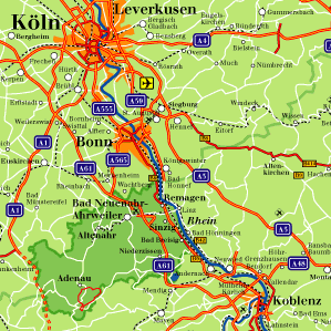
| This map shows the Rhine from Koblenz to Cologne with
Kreis-Arhweiler highlighted. Note: Kreis is
approximately equivalent to county.
|
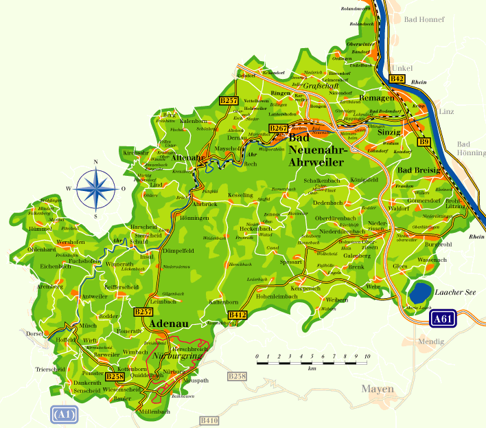
| Map of Kreis Ahrweiler. The Ahr River flows
northeast to the Rhine. At Ahrbrück the creek and
the road to Heckenbach (shown here in white) can be seen.
Nieder- and Ober-Heckenbach are near the center of the
map.
from |
If you compare this spectacular 3-dimensional
rendering of the area's topography to the map above you
can find the village and see the terrain there.
Brohl and many other places mentioned, and the Rhine
bridges, are also visible.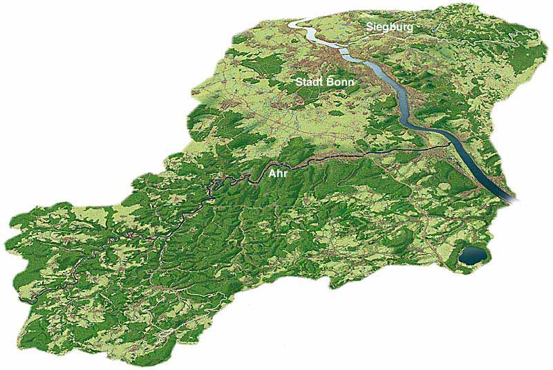 From |
Return to Home Page or to the previous map page
last updated Feb 24, 2002